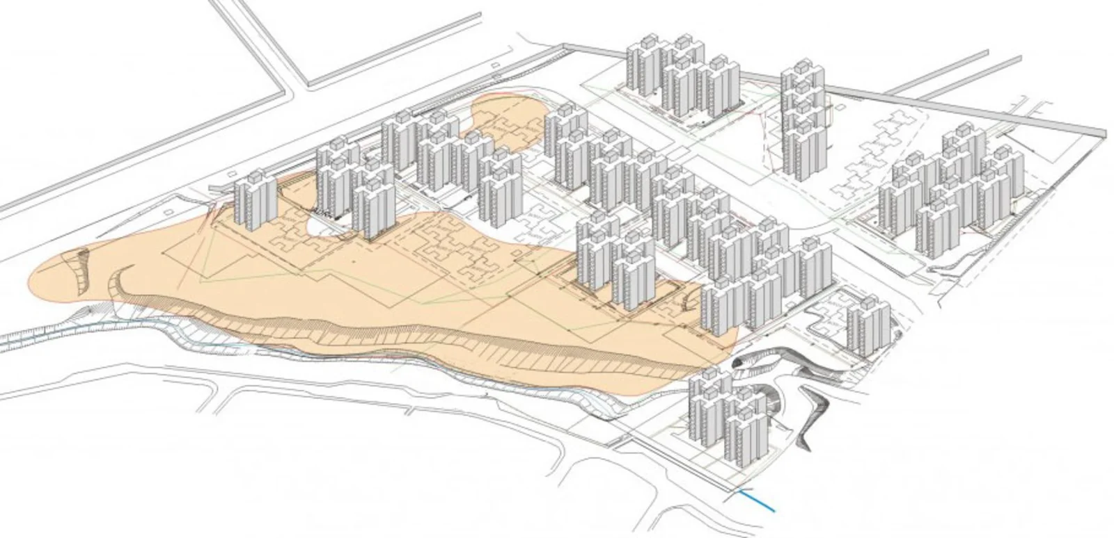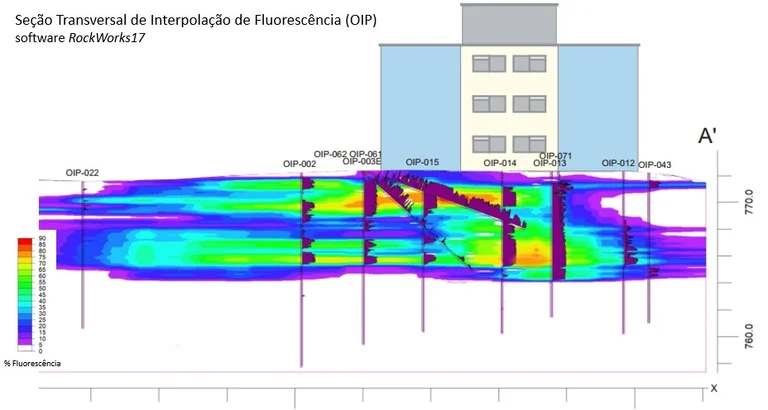
LNAPL delimitation and investigation using the high resolution OIP (Optical Image Profiler) tool, by vertical and inclined boreholes.
The research for the delimitation of LNAPL was carried out in a residential area built on an old waste landfill with thicknesses ranging from 0.1 to 15 meters with the presence of volatile organic compounds.
Was identified presence of free phase (LNAPL) with an apparent thickness of 4 meters during the investigations. Thus, the delimitation of LNAPL under these areas was necessary to subsidise the intervention and mitigation measures.
After identifying the presence of LNAPL in monitoring wells located near residential areas, EBP Brazil was hired to assess and delimit the area of occurrence of adsorbed product on soil. However, this investigation was carried out only in open areas, because residential towers are inhabited making it impossible to carry out borings in their interiors.
Therefore, high resolution (OIP) vertical and inclined boreholes were carried out on each side of the buildings.
Thus, each drilling probe was strategically positioned and calculated the best angle to drill the entire layer of waste and part of the natural soil, also observing the premise of ensuring the widest horizontal range possible to obtain a greater number of information below the areas impossible to drill.
The calculation of the drilling angle was carried out using EBP's existing database and know-how. As a safety measure, drilling was carried out taking into consideration a safe distance from the support columns and other structures of the constructions.
The results indicated significant fluorescence peaks throughout the entire waste layer (unsaturated zone), possibly due to the great heterogeneity of this material. In the natural soil (saturated zone), the fluorescence peaks become more regular and with greater intensity in the first meters. This pattern was also observed in the vertical profiles conducted in the open areas.
With the end of the investigations, the collected data were submitted to an integrated software analysis in order to elaborate the complete conceptual model of LNAPL occurrences in the region, which constitutes a fundamental piece for the elaboration of the intervention plan and actions to mitigate the associated risks.
Therefore, the use of inclined IOP has proved to be efficient for investigations in places under complex conditions, especially in occupied buildings and places with limited access.

